A sobering
look at what could go wrong
By
Will Collette

An
ad hoc task force comprised primarily of Charlestown’s professional staff had
the unenviable chore of thinking hard about all the things that could possibly
go wrong in Mother Nature’s treatment of our town.
They had to rank those calamities by
probability and severity and outline what we can do about them.
The
Charlestown Natural Hazard Mitigation Committee’s (CNHMC) work product,
Charlestown’s Natural Hazard Mitigation Plan, will be up for a public hearing
this Wednesday, April 27, from 6-7 PM at the Cross’ Mills Public Library. You can
also send comments, deadline April 29, to dboardman@charlestownri.org
The
plan is available for advance reading HERE
– highly suggested if you plan to go to the hearing.
The
Plan spans a total of 202 pages, with 123 pages of narrative, including the
Executive Summary reprinted at the end of this article.
There is also a collection of
appendices including maps and some tables detailing the history of past natural disasters that have impacted Charlestown.
While
the prose is mostly dry and professional, as you would expect from a group of
professionals studying a serious problem, it is nevertheless a very interesting
read.
You
will learn quite a lot about Charlestown’s history, social structure,
infrastructure and physical layout as the Committee reviews how natural events,
such as hurricanes, winter superstorms and sea level rise caused by climate
change, will turn the town upside down.
Here are some of the things I found especially interesting.
“Many of the changes made to the Plan were a direct result of natural hazard events such as the March 2010 flooding, Tropical Storm Irene (2011), Superstorm Sandy (2012) and Winter Storm Nemo (2013). All these events caused damage to the Town, but none more than Superstorm Sandy’s major coastal erosion, and wide-spread flooding which destroyed many homes and businesses along the coast.”
If
you are a climate-change denier, you will hate this report because it squarely
looks at the data predicting what will happen when the sea breaches the salt
ponds and gobbles up high-priced properties along the shore.
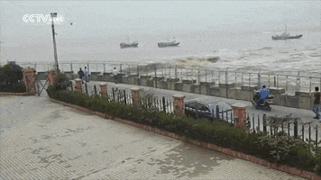
 |
| Travelling along West Beach Road in 2050 |
Most
of Charlestown’s third precinct – the Charlestown Citizens Alliance (CCA Party)
stronghold around Blue Shutters Beach and Quonnie – is likely to be reclaimed by
the ocean creating a political nightmare for them.
Imagine a Charlestown
dominated by the Democratic-leaning North of One and the Narragansett Indian
Tribe. I’m sure most CCA Party faithful figure they won’t live long enough to
see that, and they may be right. If it's any consolation to them, I doubt I will live that long either.
But
the odds are that many Charlestown residents alive today will see the kinds of
drastic changes to the topography envisioned in this report. The report notes
that existing law and public policies preclude building seawalls or dikes built
to try to stop the rising waters.
“The barrier beaches serve as a buffer between the coastal communities to the north of the salt ponds and absorb energy from storm waves. Rising sea levels will tend to push the barrier beaches back toward the base of the recessional moraine over time, compressing the salt ponds and increasing the frequency of flooding in these coastal communities. As sea level rises, salt marsh wetlands cannot migrate upland into hard structures and steep slopes [i.e. Route 1 and the moraine]. The result is that the salt marsh wetland is destroyed.” (Page 19)
On
page 44, the report states “Future coastal erosion has a highly likely probability
of occurrence (see Table 5) based on the relationship to other hazard events.
The impacts of coastal erosion affects people, disrupts potable water supplies
and wastewater utilities, and threatens coastal properties.”
On
pages 93 and 94, the report further details the threat sea level rise poses to
drinking water, which is already a problem due to rising nitrogen levels south
of Route 1. Sea level rise or a major storm surge could wreak on those water
supplies.
 The
report does not address human-based
disasters, such as a pandemic, chemical accident or a meltdown at our local
nuclear power plant (we are only 20 miles downwind from the Millstone
Nuclear Power Plant).
The
report does not address human-based
disasters, such as a pandemic, chemical accident or a meltdown at our local
nuclear power plant (we are only 20 miles downwind from the Millstone
Nuclear Power Plant).
The
report notes, but doesn’t really address unlikely natural phenomenon such as earthquake,
tsunami,
meteor strike or volcanic eruption. Despite the prominence of the Pawcatuck River,
the report considers a catastrophic dam breech to be an unlikely event.
One
factor that made this plan interesting to me is its candid, fact-based
treatment of who’s who and what’s what in Charlestown.
Without getting into the
politics, the report acknowledges the important role of the Narragansett Indian
Tribe, how our economy is really all about tourism and non-residents and little
else, how open space dominates the town geography except for the very dense
population clusters crowded along the coast, and how our population is aging.
We
are an overwhelmingly white town (94.9%) with 1.9% Native Americans. Charlestown
has a total area of 59 square miles (roughly 37,000 acres) which includes approximately 1,900 acres of
land owned by the Narragansett Indian Tribe.
Non-profits,
plus the federal, state and Charlestown governments, own 9,378 acres. Another
1,782 acres are devoted to agriculture. Another 3,061 acres are undeveloped
and, according to this report, face significant barriers to ever becoming developed.
Thus Charlestown’s tax base largely consists of 7,066 acres of residential
property and 512 acres of commercial - that's around 20% of Charlestown's total area - and much of that is under threat.

Indirectly,
the report largely explains the rise of the Charlestown Citizens Alliance which
is mostly elderly and is financed
mostly by part-time residents. In just the 20 year span, the town’s median
age increased by 47% going from 34 years in 1990 to 47 in 2010 (page 15). The
median age in the state is 42.
In
that same time period, the number of year-round housing units declined by 18% from
4,240 to 3,497. During that same period, seasonal housing increased by 7% from
1,541 to 1,654.
“Of the 5,151 total housing units counted in 2010, 3,250 were occupied, 1,654 were seasonal and 247 homes were vacant. Of the 3,250 occupied units, 83.8% were owner occupied and 16.2% were rentals. The 1,654 units that were identified as seasonal, recreational or occasional use houses – the “beach homes” for which Charlestown is famous, represent 32% of the total housing units.”

The
report candidly describes Charlestown’s economy:
“Apart from the tourist industry, Charlestown has a limited employment base of small businesses with few employees. For the year round residents, it is essentially a commuter town [but with no public transportation whatsoever – editor]. Residents work in surrounding cities and towns throughout the Rhode Island and eastern Connecticut. The demand for commercial enterprises is driven by the needs of residents and the preferences of tourists. Charlestown has undeveloped industrially-zoned land, an indication of a low demand for industrial development. Agriculture and aquaculture are growing sectors of the economy.” (Page 19)
 On
page 74, the report notes this “limited
employment base of small businesses” are mostly restaurants, construction
contractors and “strategically placed” retailers mostly along Routes 1 and 1A.
On
page 74, the report notes this “limited
employment base of small businesses” are mostly restaurants, construction
contractors and “strategically placed” retailers mostly along Routes 1 and 1A.“According to the RIDLT, roughly two thirds of Charlestown residents work outside of Charlestown. Most of these work in either South Kingstown or in Westerly, adjacent coastal communities that have more commercial and industrial employment than does Charlestown. Therefore, natural disasters that impact the south shore can have a significant impact on employment and income in Charlestown even if the event does not directly strike Charlestown.”
The
report doesn’t sugarcoat the realities of climate change. Indeed, using solid
statistical analysis, the report reinforces them.
There
is one part of the report that may cheer up the CCA Party. There is a section
on open space acquisition on page 78:
“Historically, the Town’s priority for open space acquisition include the following criteria: serve as groundwater protection, support important habitats, provide opportunities for recreation, preserve farmland, have historic, cultural and scenic qualities and/or are connected to other protected parcels. The use of public bond money and/or grants, as well as conservation easements, may be expanded to apply to areas that are vulnerable to sea level rise, flooding and storm surges, and areas that should not be built on or rebuilt on.” [Emphasis added]
There
are very few instances where the report authors stray from the “just the facts,
Jack” governmental prose. One spot was on page 90 where the report brags about
Charlestown’s achievement of the best FEMA rankings for preparedness in Rhode
Island and one of the best on the East Coast. If ever there was cause to break
discipline and use adjectives that was it.
Here
is the report’s Executive Summary:
Executive Summary
The
Natural Hazard Mitigation Plan’s mission is to preserve and enhance the quality
of life, property and resources by identifying natural hazard risks and
implementing hazard mitigation actions to protect the people of Charlestown and
its historical, cultural and natural resources.
To
address these risks and vulnerable areas, this Plan puts forth a clear mission,
distinct goals and specific mitigation actions.
The
objective of this Plan is to recommend actions and policies for the Town of
Charlestown that minimize the social and economic loss or hardships resulting
from natural hazard events.
The
Charlestown Natural Hazard Mitigation Committee (CNHMC) has been formed to ensure
the successful completion of the hazard mitigation plan update.
This
is an ongoing process that requires continuous evaluation, implementation and
revisions. It is intended that this Plan and the ongoing efforts of the CNHMC
will preserve and enhance the quality of life, property and resources for the
Town of Charlestown.
Once
Federal Emergency Management Agency FEMA approves the Charlestown Natural
Hazard Mitigation Plan, the town will receive credit points under the FEMA
Community Rating System to lower homeowner flood insurance premiums.
Moreover,
the approved FEMA plan makes Charlestown eligible for federal hazard mitigation
grants through RI Emergency Management Agency (RIEMA) and gives funding
priority to Charlestown mitigation projects.
The
Plan takes the reader through the process of creating meaningful and cost
effective actions that achieve the goals set forth by the CNHMC. The CNHMC
determined what is vulnerable and then identified action items to mitigate the
negative effects of natural disasters specific to each vulnerable area.
The
CNHMC studied local natural events and described them in terms of location on
the landscape, the scale or intensity of the event, the history of the natural
disaster and the probability of the natural disaster occurring again.
Once
the hazard profiles were complete, the CNHMC studied the impacts of natural
hazards on the community assets (that is, population, infrastructure, natural
environment and the economy) to determine what was vulnerable and to determine
the level of risk.
The
proposed mitigation actions are designed to lessen the impact of natural
disasters in vulnerable areas.
This
Plan is designed to implement mitigation actions to reduce risk.
Public
participation is critical to the success of this Plan, not only because
citizens need to know what to do before an emergency, but citizens also must be
made aware of what actions their town government is taking toward a more
resilient community.
As
illustrated in the following pages, town employees are highly skilled in
emergency management planning and completing mitigation actions. In the course
of this update, the hazard mitigation capabilities of the town departments were
evaluated.
Over
the last five years, the town has invested, implemented and performed actions
that help mitigate natural hazard situations, including enforcement of the
State Building Code. The town implements and enforces the State Building Code
and participates in the NFIP through the Building/Zoning Department.
The
entire State of Rhode Island is under the latest International Building Code
(IBC) and will be adopting the IBC 2015 with Rhode Island amendments in July of
2016.
The
State Building Codes were updated in 2000 requiring all new structures to
withstand a minimum of 110 mph winds (up from 90 mph winds).
The
town also revised FEMA Flood Insurance Rate Maps in 2013. Moreover, the town
follows the new RI Stormwater Design and Installation Standards Manual which
went into effect on January 1, 2011, which uses low impact development
techniques as the primary method of stormwater control.
CNHMC
findings on the impacts of natural disasters in Charlestown indicate that
Charlestown is vulnerable to diverse events including coastal flooding,
riverine flooding, heavy rains, storm surge, high winds (hurricanes), coastal
erosion and shoreline change.
The
discussion in the Plan puts the likelihood of these events into historical
perspective and recognizes that the probability of these events may be higher
due to the impacts from climate change and accelerated sea level rise.
The
greatest risk from natural disasters in Charlestown occurs south of Route 1
along the coast of Rhode Island. This is an area of high population density.