This should please right-wing nuts like Justin Price
Massachusetts Institute of Technology
MIT engineers have mapped the contrails that were generated over the United States in 2020, and compared the results to prepandemic years.
They found that on any
given day in 2018, and again in 2019, contrails covered a total area equal to
Massachusetts and Connecticut combined. In 2020, this contrail coverage shrank
by about 20 percent, mirroring a similar drop in U.S. flights.
While
2020's contrail dip may not be surprising, the findings are proof that the
team's mapping technique works. 
Rep. Justin Price (Wingnut-Richmond) believes the ultra-right conspiracy
theory that plane contrails are loaded with mind-altering chemicals
being spread by sinister forces
Their study marks the first time researchers
have captured the fine and ephemeral details of contrails over a large
continental scale.
Now, the researchers are applying the technique to predict where in the atmosphere contrails are likely to form.
The cloud-like formations are known to play a
significant role in aviation-related global warming. The team is working with
major airlines to forecast regions in the atmosphere where contrails may form,
and to reroute planes around these regions to minimize contrail production.
"This kind of technology can help divert planes to prevent contrails, in real time," says Steven Barrett, professor and associate head of MIT's Department of Aeronautics and Astronautics. "There's an unusual opportunity to halve aviation's climate impact by eliminating most of the contrails produced today."
Barrett
and his colleagues have published their results today in the journal Environmental
Research Letters. His co-authors at MIT include graduate student Vincent
Meijer, former graduate student Luke Kulik, research scientists Sebastian
Eastham, Florian Allroggen, and Raymond Speth, and LIDS Director and professor
Sertac Karaman.
Trail
training
About
half of the aviation industry's contribution to global warming comes directly
from planes' carbon dioxide emissions. The other half is thought to be a
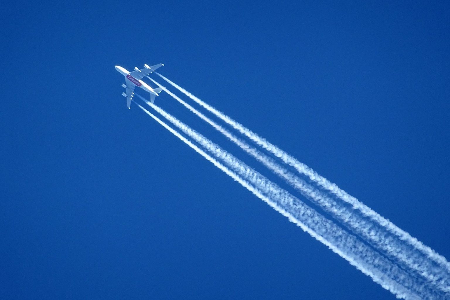
consequence of their contrails. The signature white tails are produced when a
plane's hot, humid exhaust mixes with cool humid air high in the atmosphere.
Emitted in thin lines, contrails quickly spread out and can act as blankets
that trap the Earth's outgoing heat.
While
a single contrail may not have much of a warming effect, taken together
contrails have a significant impact. But the estimates of this effect are
uncertain and based on computer modeling as well as limited satellite data.
What's more, traditional computer vision algorithms that analyze contrail data
have a hard time discerning the wispy tails from natural clouds.
To
precisely pick out and track contrails over a large scale, the MIT team looked
to images taken by NASA's GOES-16, a geostationary satellite that hovers over
the same swath of the Earth, including the United States, taking continuous,
high-resolution images.
The
team first obtained about 100 images taken by the satellite, and trained a set
of people to interpret remote sensing data and label each image's pixel as
either part of a contrail or not. They used this labeled dataset to train a
computer-vision algorithm to discern a contrail from a cloud or other image
feature.
The
researchers then ran the algorithm on about 100,000 satellite images, amounting
to nearly 6 trillion pixels, each pixel representing an area of about 2 square
kilometers. The images covered the contiguous U.S., along with parts of Canada
and Mexico, and were taken about every 15 minutes, between Jan. 1, 2018, and
Dec. 31, 2020.
The
algorithm automatically classified each pixel as either a contrail or not a
contrail, and generated daily maps of contrails over the United States. These
maps mirrored the major flight paths of most U.S. airlines, with some notable
differences. For instance, contrail "holes" appeared around major
airports, which reflects the fact that planes landing and taking off around
airports are generally not high enough in the atmosphere for contrails to form.
"The
algorithm knows nothing about where planes fly, and yet when processing the
satellite imagery, it resulted in recognizable flight routes," Barrett
says. "That's one piece of evidence that says this method really does
capture contrails over a large scale."
Cloudy
patterns
Based
on the algorithm's maps, the researchers calculated the total area covered each
day by contrails in the US. On an average day in 2018 and in 2019, U.S.
contrails took up about 43,000 square kilometers. This coverage dropped by 20
percent in March of 2020 as the pandemic set in. From then on, contrails slowly
reappeared as air travel resumed through the year.
The
team also observed daily and seasonal patterns. In general, contrails appeared
to peak in the morning and decline in the afternoon. This may be a training
artifact: As natural cirrus clouds are more likely to form in the afternoon,
the algorithm may have trouble discerning contrails amid the clouds later in
the day. But it might also be an important indication about when contrails form
most. Contrails also peaked in late winter and early spring, when more of the
air is naturally colder and more conducive for contrail formation.
The
team has now adapted the technique to predict where contrails are likely to
form in real time. Avoiding these regions, Barrett says, could take a
significant, almost immediate chunk out of aviation's global warming
contribution.
"Most
measures to make aviation sustainable take a long time," Barrett says.
"(Contrail avoidance) could be accomplished in a few years, because it
requires small changes to how aircraft are flown, with existing airplanes and
observational technology. It's a near-term way of reducing aviation's warming
by about half."
The
team is now working towards this objective of large-scale contrail avoidance
using realtime satellite observations.
This
research was supported in part by NASA and the MIT Environmental Solutions
Initiative.