Of
course NOAA is forbidden to blame climate change
 People
living on the coast may see flooded sidewalks and streets more frequently this
year due, in part, to El Nino conditions that are predicted to develop later
this year, and from long-term sea level rise trends.
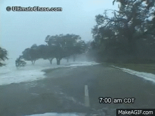
People
living on the coast may see flooded sidewalks and streets more frequently this
year due, in part, to El Nino conditions that are predicted to develop later
this year, and from long-term sea level rise trends. The projected increase in high tide flooding in 2018 may be as much as 60 percent higher across U.S. coastlines as compared to typical flooding about 20 years ago, according to NOAA scientists.
These
predictions are part of NOAA’s 2017 State of High Tide Flooding and 2018
Outlook, a report produced by NOAA’s Center for Operational
Oceanographic Products and Services every year since 2014.
The
report finds that during the 2017 meteorological year (May 2017-April 2018),
the U.S. average number of high tide flooding days was the highest measured at
98 NOAA tide gauges. More than a quarter of the coastal locations tied or
broke their individual records for high tide flood days.
The top five cities that saw the highest number of flood days across the U.S. and broke records include Boston; Atlantic City, New Jersey; Sandy Hook, New Jersey; Sabine Pass, Texas; and Galveston, Texas. These cities faced the brunt of an active nor’easter and hurricane seasons and sea level rise, which has made these and other less extreme events more impactful.
150
percent:
The
increase in annual high tide flood days for South Atlantic states (2000-2018)
As
relative sea level increases, it no longer takes a strong storm or a hurricane
to cause coastal high tide flooding. High tide flooding causes
frequent road closures, overwhelmed storm drains, and compromised
infrastructure.
Understanding
risk and flooding vulnerability in our nation’s coastal communities
The report's authors focused on more impactful, deeper high tide flooding in some locations than in previous reports.
It assesses high tide flooding based on new, national flooding thresholds released in February, which causes the number of flood days tallied in the report to be lower in some cities compared to previous years.
This
does not mean there are less flooding days. The new report uses a higher
threshold elevation at some locations such as Annapolis, Maryland, Washington,
D.C., Wilmington, North Carolina and San Francisco, meaning water must get
higher at the tide gauge before it counts as flooding.
In these locations, floods with minimal above-ground infrastructure impacts are not included.
In these locations, floods with minimal above-ground infrastructure impacts are not included.
Using
this new method helps establish a national coastal flooding vulnerability
assessment that can help identify flooding that would typically impact
infrastructure throughout a region, rather than at a single location. As they
examine their risk, communities can use this information can help better
mitigate and prepare for high tide flooding from long-term sea level rise.