By FRANK CARINI/ecoRI News staff
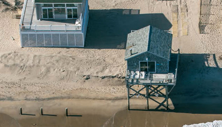 |
| Rhode Island is losing a millimeter of ground annually. That may not seem like a lot, but combined with sea-level rise, it’s playing a meaningful role in present-day flooding. (John Supancic) |
The
Ocean State is losing and has lost thousands of acres of salt marsh, much of it
to development.
These unique ecosystems are a priceless resource with
irreplaceable benefits, including their ability to protect the human-built
world from sea-level rise.
“We’re going to hit a
point when marshes can’t keep up with sea-level rise,” University of Rhode
Island researcher Simon Engelhart said.
“We need to let them migrate inland, or
we will lose them. We need to allow marshes to do what marshes do.”
He said humans should
already be retreating from the coastline. He also noted that the clearing of
trees and the destabilization of soil impacts the ability of salt marshes to
migrate inland.
Engelhart, an assistant professor in URI’s Department of GeoSciences, is investigating how the state’s coastline has responded to past sea level-rise changes and studying the influence of land subsidence from the last ice age to better understand future implications as sea level-rise projections continue to climb.
So far, his research has
found that sea-level rise is happening faster than at any point in Rhode
Island’s past 3,000 years, in part because the Ocean State is sinking.
Low-lying areas such as Island Park in Portsmouth and Oakland Beach in Warwick
are among the most vulnerable areas.
Engelhart noted that
sea-level rise is a complicated issue with many variables, such as gravity,
density changes of water, water temperatures, the strength of the Gulf Stream
and other ocean currents, the draining of aquifers, groundwater withdrawals, and
the rate of ice-sheet melting in Greenland, the West Antarctic, the East
Antarctic, and the Southern Patagonian Ice Field.
“It doesn’t go up
uniformly everywhere. The ground moves, shakes and is active,” Engelhart
said during a Feb. 14 talk at the Coastal Institute Auditorium on URI’s Bay
Campus as part of Rhode Island Sea Grant’s annual
Coastal State Discussion Series. “Sea-level rise is about what the
ocean is doing and what the land is doing.”
Although Rhode Island is
losing only 1 millimeter of ground annually, according to Engelhart, it plays a
meaningful role in present-day flooding along a coastal state that is mostly at
sea level or 10-30 feet above.
He said land subsidence — the gradual settling or
sudden sinking of the Earth’s surface owing to subsurface movement of earth
materials — “is going to be important in the short-term even though it’s small
because it’s still a component of what we’re seeing,” referring to nuisance
flooding where high tides can now cause road closures and overwhelm storm
drains. These events are expected to increase with continuing sea-level rise,
he added.
“This may seem minimal
compared to projected sea levels, but is still a significant contributor to
sea-level rise at present,” Engelhart said.
Since 1930 the Newport
tide gauge has measured about 2.7 millimeters annually of relative sea-level
rise. The Providence tide gauge has measured 2.2 millimeters. Those
measurements, however, don’t tell the full story.
“Eighty to ninety years
of data is not enough to put anything into context,” Engelhart said. “Those are
just linear rates ... they’re not accounting for the acceleration of the
current rate. There’s clear acceleration in the records of the past 25 years.
We need to address greenhouse-gas emissions.”
Last year the National
Oceanic and Atmospheric Administration increased its sea-level rise projections to up to 8
feet by 2100. The Northeast is projected to experience an additional 1-3 feet
on top of NOAA modeling.
 |
| Salt marshes are highly productive ecosystems that filter out pollution, provide habitat for wildlife and protect homes from flooding. They’re also sensitive to development. (Christopher Neill/Woods Hole Research Center) |
For the long-term
context of Rhode Island sea-level rise, Engelhart and his research
team turned to Narragansett Bay salt marshes. He explained that
salt marshes grow at different elevations to the ocean and that life in them
tells a specific story.
To read these marsh stories, Engelhart’s team has taken core samples from four salt marshes — Fox Hill, Touisset, Nag Creek and Osamequin — and closely examined their finds with radiocarbon dating.
To read these marsh stories, Engelhart’s team has taken core samples from four salt marshes — Fox Hill, Touisset, Nag Creek and Osamequin — and closely examined their finds with radiocarbon dating.
The team has plans to
expand the number of salt marshes where core samples are taken.
Salt marshes are
shoreline wetlands that are flooded and drained by salt water brought in by the
tides. These intertidal ecosystems — foraging habitat for fish, shellfish,
birds and mammals, and home to nursery areas and spawning grounds — are
essential for healthy coastlines, communities and fisheries. They are an
integral part of Rhode Island’s economy and culture.
They also have and
continue to take a pounding. For instance, more than 50 percent of Narragansett
Bay’s salt marshes have been destroyed during the past three centuries.
Much of the remaining marshes have been diminished by coastal development and failed mosquito ditching. Mosquito ditches are narrow channels that were dug to drain the upper reaches of salt marshes.
It was believed that such efforts would control mosquito breeding, but all that work did was drain salt marshes and kill off mummichogs, a mosquito-eating fish that are important prey for herons, egrets and larger predatory fish.
Healthy salt marshes
help communities, buildings, infrastructure and the environment better
withstand the impacts of sea-level rise and coastal storm surge.
Salt marshes protect shorelines from erosion by buffering wave action and trapping sediment. These vital ecosystems reduce flooding by absorbing rainwater, and protect water quality by filtering runoff and metabolizing excess nutrients, such as nitrogen.
Salt marshes protect shorelines from erosion by buffering wave action and trapping sediment. These vital ecosystems reduce flooding by absorbing rainwater, and protect water quality by filtering runoff and metabolizing excess nutrients, such as nitrogen.
Salt marshes, however,
are highly sensitive to development. Polluted stormwater runoff from inland
development can damage salt-marsh health. Engelhart also noted that the marshes
of Narragansett Bay face another problem: a lack of sediment supply.
James Boyd of the
state’s Coastal Resources Management Council partook in an informal
conversation, which included about a dozen questions from the audience, after
Engelhart’s recent presentation.
Boyd noted that if sea
level in Rhode Island rose a foot, 13 percent of the state’s remaining salt
marshes would be lost; 3 feet, 62 percent; 5 feet, 83 percent.
“Our salt marshes are in
trouble,” said the coastal policy analyst. “The ability of salt marshes to
migrate inland is the most important element. We need to preserve that upland.
That’s what will save our salt marshes: room to move.”
The impact of losing
healthy salt marsh can be seen across southern New England. The coastal portion
of the Sapowet Marsh Wildlife Management Area in Tiverton has experienced more
than 90 feet of shoreline erosion in the past 75 years, according to the Rhode
Island Department of Environmental Management.
The Nature Conservancy
and the U.S. Fish & Wildlife Service are working to restore and strengthen
salt-marsh habitat at the Sachuest Point National Wildlife Refuge in Middletown
to better withstand the impacts of sea-level rise, coastal storm surge and
coastal erosion.
Salt marshes of the
picturesque Narrow River are threatened by a combination of rising water and
human activity.
In recent years, motorboat wakes and extreme weather events such as Hurricane Sandy have destroyed 15 percent of the watershed’s marshland, according to state officials.
In recent years, motorboat wakes and extreme weather events such as Hurricane Sandy have destroyed 15 percent of the watershed’s marshland, according to state officials.
Salt-marsh islands in
the West Branch of the Westport River have declined by nearly half during the
past 80 years, according to a 2017 report.
By studying aerial
imagery of six salt-marsh islands in the river’s West Branch, scientists found
that the total area of salt marshes has consistently declined during the past
eight decades, with losses dramatically increasing in the past 15 years.
Altogether, the six islands lost a total of 12 acres of salt marsh since 1938. If marsh losses continue at the accelerated rate observed during the past 15 years, the Westport River’s marsh islands could disappear within 15 to 58 years, according to the researchers.
Altogether, the six islands lost a total of 12 acres of salt marsh since 1938. If marsh losses continue at the accelerated rate observed during the past 15 years, the Westport River’s marsh islands could disappear within 15 to 58 years, according to the researchers.
“Plan for the worst-case
scenario is the best way to handle sea-level rise,” Engelhart said. “Take the
longer-term view. There’s benefits regardless if we cut greenhouse-gas
emissions.”
Engelhart’s research
aims to provide a better understanding of future coastal hazards, to help
coastal planners make more informed decisions.