Ocean State Confronts Environmental Justice Along Its Coast
By
CYNTHIA DRUMMOND/ecoRI News contributor
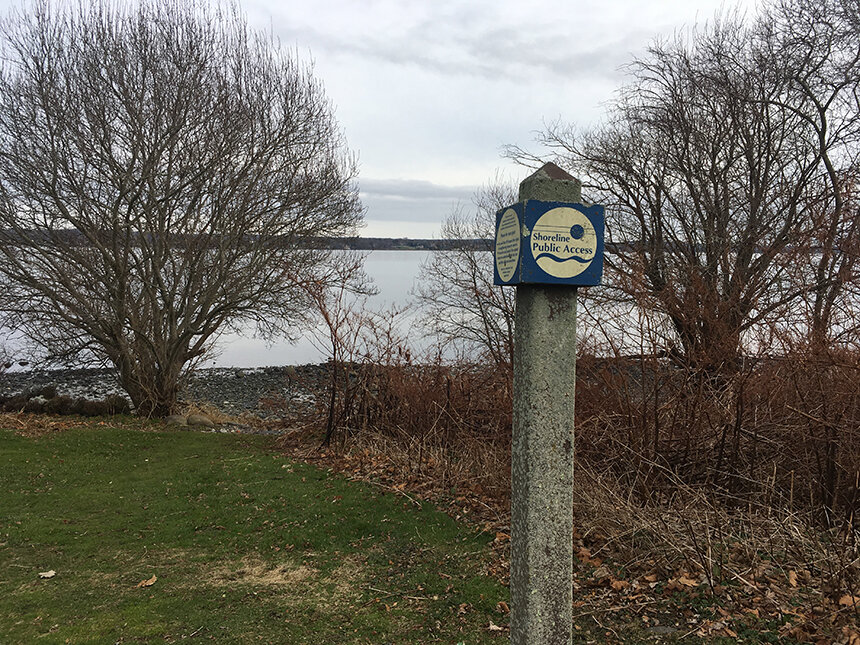 |
| Recent research has found access to Rhode Island’s shoreline and the amenities it offers differs between demographic groups. (Joanna Detz/ecoRI News) |
Rhode Island has hundreds of public shoreline access points, but for many people getting to them is a challenge.
“Shoreline Access for All: Environmental Justice along the Coast,” a June 30 webinar, the second in a series hosted by the Coastal Resources Management Council (CRMC) and Rhode Island Sea Grant, focused on shoreline access as an environmental-justice issue.
The speakers were social scientist Kate Mulvaney of the Environmental Protection Agency (EPA); Julia Twichell, geographic information system and watershed specialist at the Narragansett Bay Estuary Program; and CRMC policy analyst Leah Feldman.
Mulvaney presented findings from a study that focused on distributional justice, the sharing of environmental burdens and benefits. The EPA research focused on demographic groups and how access to shoreline amenities differed between them.
Rhode Island has more than 400 uncertified public shoreline access points — during the past seven years, CRMC has certified 222 rights of way — but water quality varies from the more urbanized upper Narragansett Bay to the beaches in South County.
“We have 30 state and town beaches, and they have the same divide in water quality,” Mulvaney said. “Within Narragansett Bay, they all have some history of some form of impairment over the last five years as compared to the southern-facing beaches that don’t have that history of impairment.”
Using a method known as “equity mapping,” researchers examined census data to determine whether different populations within Rhode Island’s cities and towns had equal access to opportunities for recreation on the coast.
“We wanted to see if there were differences in the distance that those census block groups have to travel to get to the different access points, so we looked at the distance to get to the nearest beach — to get to any beach at all — and then we looked at the average distance to the 10 closest public access points,” Mulvaney said.
While the average distance to shoreline access points in Rhode Island is only 6 miles, the average distance to clean ocean water is much farther, 22 miles.
“Populations with a higher proportion of White population have to travel less far than the census block groups that have a higher proportion of Black and Latinx,” Mulvaney said.
“When we look at beaches, it’s the same story. It’s a little bit farther for anyone to get to the beach, it’s an average of 10 miles to get to the beach for any census block group and to get to the cleanest beach, the average distance is 31 miles, but it’s a little bit closer for census block groups that have a higher proportion of population that’s White.”
The study concluded that coastal access inequities persist.
“There’s some inequities statewide in terms of coastal access opportunity and those are associated with race and ethnicity,” Mulvaney said.
“If we’re thinking about that through an equality lens, we want everyone to be the same distance from coastal access points, so thinking about, strategically, where we would put access points so that we can increase access and make it more equal. … We’re looking at everyone having a chance to get to a high-quality shoreline.”
Phone data tracks shoreline visits
Twichell presented the results of a joint Narragansett Bay Estuary Program and EPA project that used cell phone data to determine how many people were traveling to public access points, where they traveled from and which shorelines they were visiting. The study included more than 400 access points, covering all of Rhode Island and small, bordering sections of Connecticut and Massachusetts.
The data from July to September 2019, all of it anonymous, was provided by Atlanta-based AirSage Inc.
“We delineate the boundaries of the site using satellite imagery, and then we basically get these counts of visits from AirSage, based on phone pings that occurred within the boundaries,” Twichell said. “We can’t see any information, or even individual devices.”
To confirm the accuracy of the data, researchers performed in-person observations and took head counts at different coastal sites.
The data showed there were more than 2.5 million visits to public access points during summer 2019. In addition, researchers were able to see where the visitors had come from.
“Third-party apps collect sort of voluntary location tracking to make your experience with the weather app or the news app more relevant to you,” Twichell said. “So, they collect a home location that comes to us aggregated through the census plot group. … Those are geographic groupings of neighborhoods. Again, we just get simple counts for these neighborhoods, no location history.”
The data helps researchers understand which sites are visited, which amenities draw the most people and how sites could be improved. It also counts the numbers of visits, not only to beaches but all shoreline sites, including smaller rights of way.
“I think it’s very informative for us to think about balance,” Twichell said. “How are we distributing our resources for designated parking or trash services, how are we distributing those resources in a way that matches actual use of these different sites.”
The study also attempted to determine whether water quality was a factor in visits to coastal sites, including some areas with compromised water quality, such as upper Narragansett Bay.
“What it tells us is water quality certainly isn’t completely deterring visits to the coast up there,” she said. “Continuing to focus on water-quality improvements in the upper bay really does have the potential to benefit a lot of people who are using these areas, and we can create these high-quality public access points closer to home for a lot of folks.”
Increasing pressures on a fragile ecosystem
Feldman shared her research on coastal access and CRMC’s work in designing public access points.
“The fact that that this coastal zone area is limited means there’s tension between uses,” she said. “It’s a really demanded-upon area with competing interests and, of course, privatization of coastal land limits public accessibility.”
Feldman also noted that while the Rhode Island Constitution guarantees people access to the shoreline, that doesn’t mean that the shore is accessible to all.
“Getting access to the shore can be difficult, particularly in urban areas with environmental-justice concerns,” she said. “Additionally, creating and preserving lateral access along the shore gets more difficult as sea levels rise and erosion continues and, in response to those things, hardening of the shoreline proliferates.”
Feldman said segregation-era practices continue along Rhode Island’s coastline.
“There are discriminatory and preventative measures on proposed parking bans, illegal fencing, widespread private beach associations and coastal land that’s being controlled by a wealthy elite,” she said.