Work Planned to Make Popular Quonochontaug Pond and Breachway More Climate Resilient
By CYNTHIA DRUMMOND/ecoRI News contributor
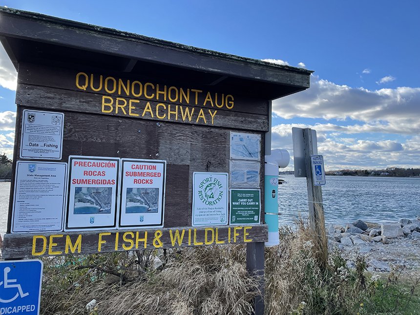
The pond, breachway, and boat launch at Quonochontaug are managed by the Rhode Department of Environmental Management. (Cynthia Drummond/for ecoRI News)
A recent assessment of the breachway that connects Quonochontaug Pond to Block Island Sound found the channel, stabilized with rock jetties, and the salt pond are in relatively good shape but are showing signs of deterioration.
Norwood, Mass.-based GZA
GeoEnvironmental Inc. has been contracted to design and present coastal
resiliency strategies for the popular boating and fishing access site.
During a Nov. 18 online
public information meeting hosted by the Rhode Island Department of Environmental
Management (DEM), which owns and manages the public boat launch and about 40
acres of the property, the discussion focused on improving the pond and
breachway’s resiliency in the face of rising sea levels and other
climate-crisis impacts.
Nature Conservancy
conservation engineer Jillian Thompson, who is currently working in DEM’s
Division of Planning & Development, said the assessment was partly funded
by a $90,000 grant from the U.S. Fish & Wildlife Service’s National Coastal Resilience Fund
and by saltwater angler license fees. The entire project is expected to cost
between $125,000 and $135,000.
“This fund makes
investments to strengthen natural systems,” Thompson said. “These natural
systems protect coastal communities from the impacts of storms, floods,
sea-level rise, and other hazards. It enables communities to recover more
quickly, and they also enhance habitat for important fish and wildlife populations.”
Quonochontaug Pond, commonly referred to as
“Quonnie,” is one of 10 coastal lagoons along the state’s South County
shoreline. They serve as an important first line of defense against coastal
storms and flooding.

The salt marsh at Quonochontaug is closed as it undergoes a restoration lead by Save The Bay. The marsh is one of several components undergoing an assessment to determine whether they can withstand the impacts of climate change. (Cynthia Drummond/for ecoRI News)
Quonnie Pond, which lies in both Charlestown and Westerly, is the deepest and saltiest of Rhode Island’s 10 saltwater lagoons. The 700-acre pond’s adjacent 80-acre salt marsh, which is being restored by Save The Bay and its partners, provides habitat for fish and birds.
The breachway, first built in the 1950s and
fortified and straightened in the ’60s, connects the pond and the open ocean.
It was dredged in 2019 as part of a Quonnie Pond restoration project. DEM added
a new boat launch a year later.
“This salt marsh and
pond complex, it provides the first line of defense against coastal storms and
it also contributes to the ecological diversity and health of the area
overall,” Thompson said.
In addition to intensive
public use, Quonnie Pond is impacted by several factors, according to Thompson.
“The breachway
shoreline, the adjacent land, it’s in poor condition,” she said. “We’re losing
land. There’s land retreat going on, there’s erosion from mismanaged
stormwater, from sea-level rise, from storm surge impacts, and there are issues
that need to be addressed, and it needs to be at the coastal resiliency level.”
GZA GeoEnvironmental has
assessed the condition of the salt pond, breachway, marsh, and access road and
has proposed measures that would mitigate the problems currently threatening
Quonnie to make the pond and surrounding land more resilient to future climate
threats.
GZA engineer Bin Wang
explained the results of the “site vulnerability assessment” and invited
participants to provide input on the results.
The stone wall, or
revetment, lining the sides of the breachway is showing decay along its top, or
crest. Other issues of particular concern are the frequent flooding of the only
access road to the boat launch and the parking lot.
“We realize that there’s
some stormwater issues where the access road connects to the town road, where
water pools up regularly and carries some damage to the roadway surface,” Wang
said. “And then the entrance parking is not ideally, I would say, laid out, so
people actually park kind of randomly.”
GZA engineers used
Coastal Resources Management Council (CRMC) STORMTOOLS mapping to
evaluate the area with 1 foot of sea-level rise, which is projected to occur by
2035 and will render the road to the boat launch impassable.
Among the proposed
mitigation measures, which would be undertaken in phases, are restoring the
height of the revetment to keep water in the breachway from flooding the banks;
realigning and raising the access road by 5 feet and redesigning the parking
area; and changing the traffic pattern to one way to improve safety. The strong
flow of water through the breachway would also be slowed by structures built on
the bottom of the channel.

The access road to Quonochontaug Pond floods often, and the engineering firm assessing the salt pond has warned that sea-level rise will render the road impassable unless it is raised. (Cynthia Drummond/for ecoRI News)
Participants
had questions about wildlife and birds, invasive plants, and the lack of public
access to the mouth of the breachway, none of which was studied during the
recent assessment.
Local
resident Joan Morin asked if more parking would be added to the boat launch
area, which is usually full during the summer.
“Will
the changes result in more or less available parking?” she asked.
Wang
replied, “Not less, but not significantly more.”
Save
The Bay’s David Prescott asked how the access road, which is a continuation of
town-owned West Beach Road, would be raised to keep it from flooding.
“That’s
a really good question we’ve been scratching our heads about,” GZA engineer
Russell Morgan said. “How do we change that grade, coming from, obviously, a
low area of the public road or the town road onto this asset of the state? We
would obviously have some sort of gradual incline to get to the new resilient
road elevation, and I think the real engineering solution here, that is the
tough nut to crack, is the control of stormwater, so that if these improvements
are made, we’re not adding to the water that collects at the end of that town
road.”
Engineers
will continue to develop resiliency measures to protect Quonnie Pond and its
salt marsh from rising seas and other impacts of climate change.
The
public can submit feedback to DEM until the end of the month at
DEM.projects@dem.ri.gov.
In
addition to The Nature Conservancy, project partners include CRMC, Save The
Bay, the Salt Ponds Coalition, Charlestown’s Coastal Ponds Management
Commission, and the National Oceanic and Atmospheric Agency.